Файл:Bavaria relief location map.jpg

Памер папярэдняга прагляду: 608 × 600 пікселяў. Іншыя разрозненні: 243 × 240 пікселяў | 487 × 480 пікселяў | 779 × 768 пікселяў | 1 038 × 1 024 пікселяў | 1 695 × 1 672 пікселяў.
Арыгінальны файл (1 695 × 1 672 кропак, аб’ём файла: 1,14 MB, тып MIME: image/jpeg)
Тлумачэнне
| Апісанне |
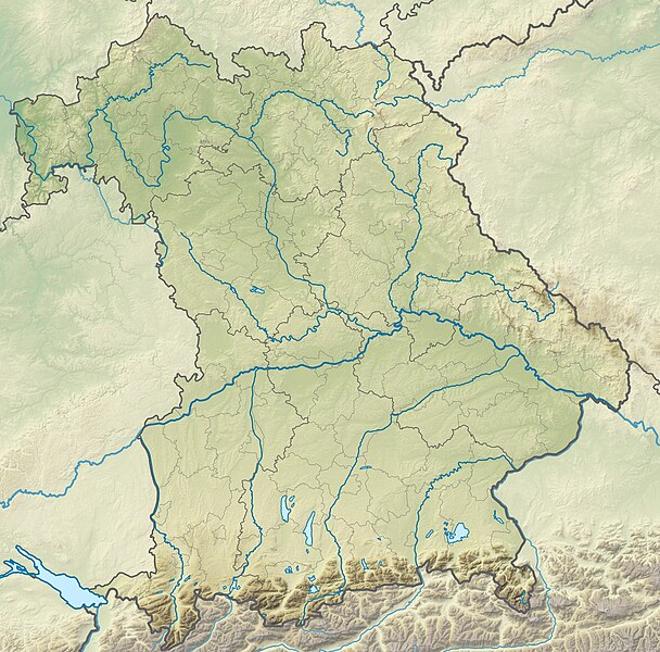
Deutsch: Physische Positionskarte Bayern, Deutschland. Geographische Begrenzung der Karte:
English: Physical Location map Bavaria, Germany. Geographic limits of the map:
|
| Дата | |
| Крыніца |
Уласная праца |
| Аўтар | Grundkarte TUBS, Relief Alexrk2 |
| Іншыя версіі |
|

Ліцэнзіяванне
Я, уладальнік аўтарскіх правоў на гэты твор, добраахвотна публікую яго на ўмовах наступных ліцэнзій:

|
Дазваляецца капіяваць, распаўсюджваць і(або) мадыфікаваць гэты дакумент на ўмовах ліцэнзіі GNU FDL версіі 1.2 або навейшай, выдадзенай Фондам свабоднага праграмнага забеспячэння; без Нязменных раздзелаў, без тэкстаў Вокладак. Копія ліцэнзіі ёсць у раздзеле GNU Free Documentation License. |
Гэты файл даступны па ліцэнзіям Creative Commons Пазначэнне аўтарства - На тых самых умовах 3.0 Непартаваная, 2.5 Агульны, 2.0 Агульны і 1.0 Агульны.
- Вы можаце свабодна:
- дзяліцца творам – капіраваць, распаўсюджваць і перадаваць гэты твор.
- ствараць вытворныя творы – адаптаваць гэты твор
- Пры выкананні наступных умоў:
- атрыбуцыя – вы павінны пазначыць аўтарства гэтага твора, даць спасылку на ліцэнзію і пазначыць ці рабіў аўтар якія-небудзь змены. Гэта можна рабіць кожным зразумелым чынам, але не так, каб наводзіць па думку, што ліцэнзіят падтрымлівае вас або выкарыстанне вамі гэтага твора.
- распаўсюджванне на тых жа ўмовах – Калі вы змяняеце, адаптуеце ці ствараеце вытворны твор на аснове гэтага, то павінны распаўсюджваць атрыманы ў выніку твор на ўмовах такой самай ці сумяшчальнай ліцэнзіі, што і арыгінал.
Вы можаце выбраць любую з гэтых ліцэнзій.
Гісторыя файла
Націснуць на даце з часам, каб паказаць файл, якім ён тады быў.
| Дата і час | Драбніца | Памеры | Удзельнік | Тлумачэнне | |
|---|---|---|---|---|---|
| актуальн. | 15:17, 19 лістапада 2009 | | 1 695 × 1 672 (1,14 MB) | Alexrk2 | == {{int:filedesc}} == {{Information |Description= {{de|Physische Positionskarte Bayern, Deutschland. Geographische Begrenzung der Karte:}} {{en|Physical Location map Bavaria, Germany. Geographic limits of the map:}} * N: |
Выкарыстанне файла
Наступныя 2 старонкі выкарыстоўваюць гэты файл:
Глабальнае выкарыстанне файла
Гэты файл выкарыстоўваецца ў наступных вікі:
- Выкарыстанне ў als.wikipedia.org
- Выкарыстанне ў an.wikipedia.org
- Chiemsee
- Tüttensee
- Río Traun (Bavera)
- Rote Traun
- Hochfelln
- Hochgern
- Achental (Bavera)
- Watzmann
- Waginger See
- Río Itz
- Königssee
- Ammersee
- Río Ammer
- Laco de Starnberg
- Eibsee
- Tegernsee (laco)
- Pilsensee
- Wörthsee (laco)
- Weßlinger See
- Feringasee
- Walchensee
- Egglburger See
- Lacos de Seeon
- Unterschleißheimer See
- Unterföhringer See
- Zugspitze
- Kochelsee
- Hoher Peißenberg
- Sylvensteinspeicher
- Río Würm
- Großer Brombachsee
- Schliersee (laco)
- Spitzingsee
- Wendelstein
- Altmühlsee
- Glaciar de Blaueis
- Río Lech
- Выкарыстанне ў ar.wikipedia.org
- Выкарыстанне ў ast.wikipedia.org
Паказаць глабальнае выкарыстанне гэтага файла.