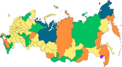
Файл:Map of federal subjects of Russia (2022), disputed Crimea and Donbass.svg

Памер гэтага PNG-прагляду для SVG-файла: 512 × 282 пікселяў. Іншыя разрозненні: 320 × 176 пікселяў | 640 × 353 пікселяў | 1 024 × 564 пікселяў | 1 280 × 705 пікселяў | 2 560 × 1 410 пікселяў.
Арыгінальны файл (файл SVG, намінальна 512 × 282 кропак, аб’ём файла: 827 KB)
,_disputed_Crimea_and_Donbass.svg)

|
The boundaries on this map show the de facto situation. This is just one of several different views on the subject (see COM:NPOV). |
Тлумачэнне
| Апісанне |
English: Copy of File:Map of federal subjects of Russia (2022).svg with disputed annexed Ukrainian territories indicated with diagonal stripes |
| Дата | |
| Крыніца |
This file was derived from: Map of federal subjects of Russia 2014, disputed Crimea.svg |
| Аўтар | Mzajac, Ltbubbas |
.svg)
Ліцэнзіяванне
| This map is ineligible for copyright and therefore in the public domain, because it consists entirely of information that is common property and contains no original authorship. For more information, see Commons:Threshold of originality § Maps.
|
Гісторыя файла
Націснуць на даце з часам, каб паказаць файл, якім ён тады быў.
| Дата і час | Драбніца | Памеры | Удзельнік | Тлумачэнне | |
|---|---|---|---|---|---|
| актуальн. | 22:48, 4 кастрычніка 2022 | | 512 × 282 (827 KB) | Techso01 | Uploaded a work by Mzajac, Ltbubbas from {{derived from|Map of federal subjects of Russia (2014), disputed Crimea.svg}} with UploadWizard |
Выкарыстанне файла
Наступная 1 старонка выкарыстоўвае гэты файл:
Глабальнае выкарыстанне файла
Гэты файл выкарыстоўваецца ў наступных вікі:
- Выкарыстанне ў ab.wikipedia.org
- Выкарыстанне ў ar.wikipedia.org
- Выкарыстанне ў ast.wikipedia.org
- Выкарыстанне ў cs.wikipedia.org
- Выкарыстанне ў de.wikipedia.org
- Выкарыстанне ў en.wikipedia.org
- Выкарыстанне ў es.wikipedia.org
- Выкарыстанне ў fa.wikipedia.org
- Выкарыстанне ў fr.wikipedia.org
- Выкарыстанне ў is.wikipedia.org
- Выкарыстанне ў it.wikipedia.org
- Выкарыстанне ў ja.wikipedia.org
- Выкарыстанне ў ko.wikipedia.org
- Выкарыстанне ў la.wikipedia.org
- Выкарыстанне ў lez.wikipedia.org
- Выкарыстанне ў lld.wikipedia.org
- Выкарыстанне ў lt.wikipedia.org
- Выкарыстанне ў lv.wikipedia.org
- Выкарыстанне ў mi.wikipedia.org
- Выкарыстанне ў oc.wikipedia.org
- Выкарыстанне ў pt.wikipedia.org
- Выкарыстанне ў ru.wikipedia.org
- Выкарыстанне ў sl.wikipedia.org
- Выкарыстанне ў sr.wikipedia.org
- Выкарыстанне ў th.wikipedia.org
- Выкарыстанне ў tly.wikipedia.org
- Выкарыстанне ў tum.wikipedia.org
- Выкарыстанне ў uk.wikipedia.org
- Выкарыстанне ў uz.wikipedia.org
- Выкарыстанне ў vi.wikipedia.org
- Выкарыстанне ў vls.wikipedia.org
- Выкарыстанне ў zh.wikipedia.org
Паказаць глабальнае выкарыстанне гэтага файла.
,_disputed_Crimea_and_Donbass.svg)
,_disputed_Crimea_and_Donbass.svg)