Файл:View from the Byzantine Tower at Meskene, ancient Barbalissos.jpg
Арыгінальны файл (1 536 × 1 024 кропак, аб’ём файла: 371 KB, тып MIME: image/jpeg)
Тлумачэнне
| Апісанне |
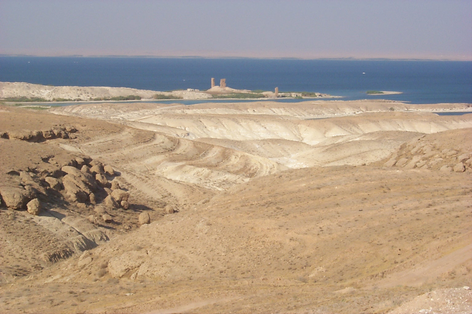
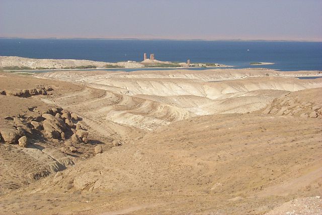
Five km to the northeast of Meskene, on the edges of Lake Assad, Syria, there is a solitary 13th-century Ayyubid brick-built octagonal minaret with stairs inside leading up to the top, from where there are panoramic views out onto the lake. A little beyond the minaret, on the shores of the lake, there are a few insubstantial ruins dating from the Byzantine period. This is all that remains of an ancient transit point on the Euphrates where caravans on the trade route between the Mediterranean and Mesopotamia switched between land and river transport. The area of land between the modern town and the minaret is criss-crossed by irrigation channels, making it difficult to reach it directly. One route is as follows: 2 km beyond Meskene’s police post (by the road on the right at the east edge of the town), turn left along a small road running along the east side of a large irrigation channel. After just over 4 km, turn left to cross over the channel on a bridge and follow a smaller irrigation channel running off the main one at right angles. After just under 2 km, turn right and cross over this channel on another bridge. The surfaced road now turns to a rough track running through a village. Around 500 m further on you come to a kind of T-junction, from where the tower is visible up ahead. According to archeological as well as to written material, the history of the ancient town of Emar came to an end in the first third of the 12th century BC. Many centuries passed before life stirred again in the ruins of Emar, presumably in Achemenian times. Apart from a Corinthian capital that came down to us as spoil we know about the Achemenian town of Bala or about the later Hellenistic and Roman towns only from texts. A change comes in Byzantine times. Justinian II let the eastern boundaries of his empire be secured by fortresses and the town that was now called Barbalissos be surrounded by strong walls. In the west, where the land rises and is most open to possible attacks, two mighty corner towers were added, spacious enough to house the guards and, at 25 meters, high enough to allow a far view into the Euphrates valley. Due to its elevated position, this western part of the town-wall has survived to this day. The ruins of the southwestern corner tower and of the so-called praetorium in the north are still an impressive landmark that is visible from afar. With the winter storms, the lake continued to erode the banks and seriously threatened the existence of this cultural monument. In this precarious situation, the German Ministry of Foreign Affairs came to the rescue and granted means with which the southwest tower was secured in 2000, already. In the first place, an access had to be prepared; for about half of its length, it is a dam newly piled up along the southern bank. The tower itself got a new foundation consisting of 90 m3 of cement; the façade was covered with original tiles gathered in the ruin. The next object to be salvaged was the praetorium two walls of which – ruined but still 20 meters high – form the northwestern corner. Here, too, the further existence of the ruin was endangered by a deep gap in the corner. In the summer of 2001, the debris sloping in front of the wall was removed so that it was easier to estimate the extent of the damage. It became obvious that the western wall with its embrasures was almost completely intact. In the summer of 2002 and again with the financial support of the Ministry of Foreign Affairs, the northern bank was strengthened, the dangerous gap at the corner of the praetorium was filled and the façade covered with tiles baked in the traditional way. At the same time, the documentation of the ruin, financed by the University of Tübingen, was completed: an object of cultural heritage has been preserved, in reality and in scientific documentation. |
| Дата | |
| Крыніца | View from the Byzantine Tower at Meskene, ancient Barbalissos |
| Аўтар | James Gordon from Los Angeles, California, USA |
Ліцэнзіяванне
- Вы можаце свабодна:
- дзяліцца творам – капіраваць, распаўсюджваць і перадаваць гэты твор.
- ствараць вытворныя творы – адаптаваць гэты твор
- Пры выкананні наступных умоў:
- атрыбуцыя – вы павінны пазначыць аўтарства гэтага твора, даць спасылку на ліцэнзію і пазначыць ці рабіў аўтар якія-небудзь змены. Гэта можна рабіць кожным зразумелым чынам, але не так, каб наводзіць па думку, што ліцэнзіят падтрымлівае вас або выкарыстанне вамі гэтага твора.
| This image was originally posted to Flickr by james_gordon_losangeles at https://www.flickr.com/photos/79139277@N08/7435754992. It was reviewed on 29 кастрычніка 2012 by FlickreviewR and was confirmed to be licensed under the terms of the cc-by-2.0. |
Гісторыя файла
Націснуць на даце з часам, каб паказаць файл, якім ён тады быў.
| Дата і час | Драбніца | Памеры | Удзельнік | Тлумачэнне | |
|---|---|---|---|---|---|
| актуальн. | 15:04, 29 кастрычніка 2012 | | 1 536 × 1 024 (371 KB) | Stobkcuf | == {{int:filedesc}} == {{Information |Description=Five km to the northeast of Meskene, on the edges of Lake Assad, Syria, there is a solitary 13th-century Ayyubid brick-built octagonal minaret with stairs inside leading up to the top, from where there ... |
Выкарыстанне файла
Наступная 1 старонка выкарыстоўвае гэты файл:
Глабальнае выкарыстанне файла
Гэты файл выкарыстоўваецца ў наступных вікі:
- Выкарыстанне ў ar.wikipedia.org
- Выкарыстанне ў bg.wikipedia.org
- Выкарыстанне ў ca.wikipedia.org
- Выкарыстанне ў en.wikipedia.org
- Выкарыстанне ў es.wikipedia.org
- Выкарыстанне ў he.wikipedia.org
- Выкарыстанне ў it.wikipedia.org
- Выкарыстанне ў ja.wikipedia.org
- Выкарыстанне ў pt.wikipedia.org
- Выкарыстанне ў sl.wikipedia.org
- Выкарыстанне ў tr.wikipedia.org
- Выкарыстанне ў www.wikidata.org