Файл:CoropunaSouthViewUSGS.jpg
Няма версіі з большай раздзяляльнасцю.
CoropunaSouthViewUSGS.jpg (640 × 409 кропак, аб’ём файла: 25 KB, тып MIME: image/jpeg)
Тлумачэнне
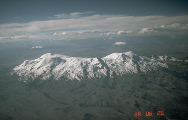
| Апісанне | Aerial photo of Nevado Coropuna, Peru's largest and highest volcano, from the south. The true summit (left) is located at the NW end of the vast summit plateau. | |||
| Location | Southern Peru | |||
| Дата | ||||
| Крыніца | https://volcano.si.edu/volcano.cfm?vn=354003&vtab=Photos | |||
| Аўтар | Norm Banks, U.S. Geological Survey | |||
| Дазвол (Паўторнае выкарыстанне гэтага файла) |
|
Гісторыя файла
Націснуць на даце з часам, каб паказаць файл, якім ён тады быў.
| Дата і час | Драбніца | Памеры | Удзельнік | Тлумачэнне | |
|---|---|---|---|---|---|
| актуальн. | 07:25, 22 красавіка 2007 | | 640 × 409 (25 KB) | Seattle Skier | == Summary == {{Information |Description= Aerial photo of Nevado Coropuna, Peru's largest and highest volcano, from the south. The true summit (left) is located at the NW end of the vast summit plateau. |Source=http://www.volcano. |
Выкарыстанне файла
Наступныя 3 старонкі выкарыстоўваюць гэты файл:
Глабальнае выкарыстанне файла
Гэты файл выкарыстоўваецца ў наступных вікі:
- Выкарыстанне ў ay.wikipedia.org
- Выкарыстанне ў ca.wikipedia.org
- Выкарыстанне ў en.wikipedia.org
- Выкарыстанне ў lt.wikipedia.org
- Выкарыстанне ў qu.wikipedia.org
- Выкарыстанне ў uk.wikipedia.org