Файл:Fly River.PNG
Няма версіі з большай раздзяляльнасцю.
Fly_River.PNG (364 × 458 кропак, аб’ём файла: 169 KB, тып MIME: image/png)
Тлумачэнне
| Апісанне |
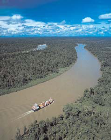
English: Arial view of Fly River, New Guinea |
| Дата | |
| Крыніца | http://msi.nga.mil/MSISiteContent/StaticFiles/NAV_PUBS/SD/Pub164/Pub164bk.pdf, page 126 |
| Аўтар | National Geospatial-Intelligence Agency |
Ліцэнзіяванне
This work is in the public domain in the United States because it is a work prepared by an officer or employee of the United States Government as part of that person’s official duties under the terms of Title 17, Chapter 1, Section 105 of the US Code.
Note: This only applies to original works of the Federal Government and not to the work of any individual U.S. state, territory, commonwealth, county, municipality, or any other subdivision. This template also does not apply to postage stamp designs published by the United States Postal Service since 1978. (See § 313.6(C)(1) of Compendium of U.S. Copyright Office Practices). It also does not apply to certain US coins; see The US Mint Terms of Use.
|
 | |
| Гэты файл быў ідэнтыфікаваны як вольны ад вядомых абмежаванняў, згодна з законам аб аўтарскім праве, а таксама ад усіх сумежных правоў. | ||
Гісторыя файла
Націснуць на даце з часам, каб паказаць файл, якім ён тады быў.
| Дата і час | Драбніца | Памеры | Удзельнік | Тлумачэнне | |
|---|---|---|---|---|---|
| актуальн. | 00:54, 16 ліпеня 2015 | | 364 × 458 (169 KB) | Cmdrjameson | Compressed with pngout. Reduced by 114kB (40% decrease). |
| 10:00, 20 кастрычніка 2011 |  | 364 × 458 (283 KB) | Ratzer | {{Information |Description ={{en|1=map of Fly River, New Guinea}} |Source =http://msi.nga.mil/MSISiteContent/StaticFiles/NAV_PUBS/SD/Pub164/Pub164bk.pdf, page 126 |Author =National Geospatial-Intelligence Agency |Date =2011 |P |
Выкарыстанне файла
Наступныя 2 старонкі выкарыстоўваюць гэты файл:
Глабальнае выкарыстанне файла
Гэты файл выкарыстоўваецца ў наступных вікі:
- Выкарыстанне ў af.wikipedia.org
- Выкарыстанне ў als.wikipedia.org
- Выкарыстанне ў arz.wikipedia.org
- Выкарыстанне ў be-tarask.wikipedia.org
- Выкарыстанне ў bg.wikipedia.org
- Выкарыстанне ў ceb.wikipedia.org
- Выкарыстанне ў cs.wikipedia.org
- Выкарыстанне ў de.wikipedia.org
- Выкарыстанне ў en.wikipedia.org
- Выкарыстанне ў eo.wikipedia.org
- Выкарыстанне ў es.wikipedia.org
- Выкарыстанне ў et.wikipedia.org
- Выкарыстанне ў fr.wikipedia.org
- Выкарыстанне ў hr.wikipedia.org
- Выкарыстанне ў hu.wikipedia.org
- Выкарыстанне ў ja.wikipedia.org
- Выкарыстанне ў ko.wikipedia.org
- Выкарыстанне ў lt.wikipedia.org
- Выкарыстанне ў nl.wikipedia.org
- Выкарыстанне ў no.wikipedia.org
- Выкарыстанне ў pt.wikipedia.org
- Выкарыстанне ў sh.wikipedia.org
- Выкарыстанне ў sr.wikipedia.org
- Выкарыстанне ў trv.wikipedia.org
- Выкарыстанне ў uk.wikipedia.org
- Выкарыстанне ў vec.wikipedia.org
- Выкарыстанне ў www.wikidata.org
- Выкарыстанне ў zh.wikipedia.org