Файл:Germany - Location Map (2013) - DEU - UNOCHA.svg

Арыгінальны файл (файл SVG, намінальна 250 × 250 кропак, аб’ём файла: 1 015 KB)
_-_DEU_-_UNOCHA.svg)
Тлумачэнне
| Апісанне |
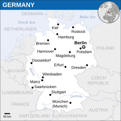
English: Locator map of Germany. |
| Дата | |
| Крыніца |
English: Germany Locator Map (ReliefWeb), ESRI, UNCS, OCHA |
| Аўтар | |
| SVG genesis | Гэты файл (вектарная выява) быў створаны з дапамогай Inkscape. |
Ліцэнзіяванне
- Вы можаце свабодна:
- дзяліцца творам – капіраваць, распаўсюджваць і перадаваць гэты твор.
- ствараць вытворныя творы – адаптаваць гэты твор
- Пры выкананні наступных умоў:
- атрыбуцыя – вы павінны пазначыць аўтарства гэтага твора, даць спасылку на ліцэнзію і пазначыць ці рабіў аўтар якія-небудзь змены. Гэта можна рабіць кожным зразумелым чынам, але не так, каб наводзіць па думку, што ліцэнзіят падтрымлівае вас або выкарыстанне вамі гэтага твора.
 This map is part of a collection of 216 free country maps, created by the UN Office for the Coordination of Humanitarian Affairs (OCHA), to be used in print, web or broadcast products.
The ReliefWeb Location Maps released here are maps that highlight a country, its capital, major populated places and the surrounding regions. Attribution Requirements
Using the map without modifications: ensure that the sources and the disclaimer are below the map. Credit as follows: "Credit: OCHA". For use with alteration: remove the OCHA logo and disclaimer following any modification to the map, but keep the data sources as mentioned below the map. Credit the modified map as follows: "Based on OCHA map". You are responsible for the content of your map. We are keen to receive your feedback and hear how you used OCHA's maps. We would be grateful if you would notify us by e-mail and share your work with us. UN Disclaimer
The designations employed and the presentation of material of this map do not imply the expression of any opinion whatsoever on the part of the Secretariat of the United Nations concerning the legal status of any country, territory, city or area or of its authorities or concerning the delimitation of its frontiers or boundaries. |

|
Textual information (e.g. timestamp) once visible in the image itself has been moved into the image metadata and/or image description page. This makes the image easier to reuse and more language-neutral, and makes the text easier to process and search for. Commons discourages placing visible textual information in images. All licenses accepted on Commons permit this type of modification as a derivative work.
If attribution information were removed and the image is not public domain, replace this tag with {{Attribution metadata from licensed image}}.
|
Гісторыя файла
Націснуць на даце з часам, каб паказаць файл, якім ён тады быў.
| Дата і час | Драбніца | Памеры | Удзельнік | Тлумачэнне | |
|---|---|---|---|---|---|
| актуальн. | 18:05, 24 мая 2022 | | 250 × 250 (1 015 KB) | Nyilvoskt | File uploaded using svgtranslate tool (https://svgtranslate.toolforge.org/). Added translation for id. |
| 15:31, 19 сакавіка 2016 |  | 250 × 250 (1 012 KB) | Wereldburger758 | Resized page to drawing. Removal watermark. Validation of image. Removal empty elements. | |
| 03:14, 21 красавіка 2014 |  | 254 × 254 (989 KB) | UN OCHA maps bot | == {{int:filedesc}} == {{Information |description={{en|1=Locator map of Germany.}} |date=2013 |source={{en|1=[http://reliefweb.int/map/germany/germany-location-map-2013 Germany Locator Map (ReliefWeb)]}} |author={{en|1=[[w:en:United Na... |
Выкарыстанне файла
Няма старонак, якія выкарыстоўваюць гэты файл.
Глабальнае выкарыстанне файла
Гэты файл выкарыстоўваецца ў наступных вікі:
- Выкарыстанне ў id.wikipedia.org
- Выкарыстанне ў incubator.wikimedia.org
_-_DEU_-_UNOCHA.svg)