Файл:London Blitz 791940.jpg

Памер папярэдняга прагляду: 800 × 519 пікселяў. Іншыя разрозненні: 320 × 208 пікселяў | 640 × 415 пікселяў | 1 024 × 664 пікселяў | 1 280 × 830 пікселяў | 2 954 × 1 916 пікселяў.
Арыгінальны файл (2 954 × 1 916 кропак, аб’ём файла: 1,21 MB, тып MIME: image/jpeg)
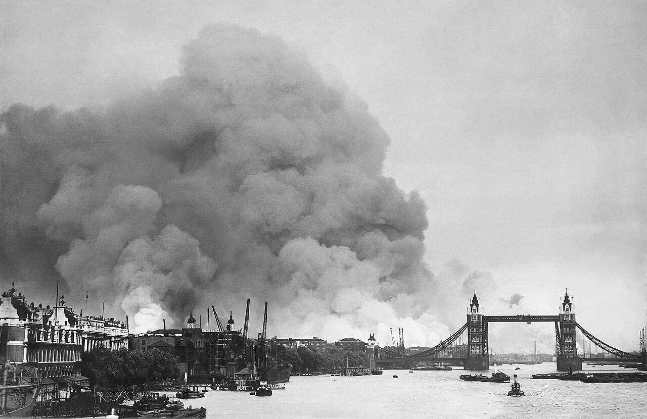
| Апісанне | View along the River Thames in London towards smoke rising from the London docks after an air raid during the Blitz. | ||||||
| Дата | |||||||
| Крыніца |
|
||||||
| Аўтар | New York Times Paris Bureau Collection. | ||||||
| Дазвол (Паўторнае выкарыстанне гэтага файла) |
|
||||||
| Іншыя версіі | File:This picture, taken during the first mass air raid on London, 7th September 1940, describes more than words ever... - NARA - 541917.tif | ||||||

| Camera location | | View this and other nearby images on: OpenStreetMap |
|---|
Гісторыя файла
Націснуць на даце з часам, каб паказаць файл, якім ён тады быў.
| Дата і час | Драбніца | Памеры | Удзельнік | Тлумачэнне | |
|---|---|---|---|---|---|
| актуальн. | 01:42, 31 мая 2022 | | 2 954 × 1 916 (1,21 MB) | Smalljim | Re-process original file. Rm blemishes, de-noise. |
| 05:06, 12 снежня 2013 |  | 2 940 × 1 916 (2,97 MB) | G-13114 | Higher resolution | |
| 03:24, 10 кастрычніка 2010 |  | 750 × 468 (249 KB) | G-13114 | Reverted to version as of 01:05, 24 May 2008 | |
| 00:38, 8 верасня 2010 |  | 625 × 390 (199 KB) | ALE! | Reverted to version as of 02:57, 18 December 2007 | |
| 04:05, 24 мая 2008 |  | 750 × 468 (249 KB) | G-Man | Enlarged | |
| 05:57, 18 снежня 2007 |  | 625 × 390 (199 KB) | G-Man | {{Information |Description= View along the River Thames towards smoke rising from the London docklands after an air raid during the Blitz. |Source= {{NARA-image|id=791940}} |D |
Выкарыстанне файла
Наступная 1 старонка выкарыстоўвае гэты файл:
Глабальнае выкарыстанне файла
Гэты файл выкарыстоўваецца ў наступных вікі:
- Выкарыстанне ў af.wikipedia.org
- Выкарыстанне ў ar.wikipedia.org
- Выкарыстанне ў ast.wikipedia.org
- Выкарыстанне ў azb.wikipedia.org
- Выкарыстанне ў az.wikiquote.org
- Выкарыстанне ў ca.wikipedia.org
- Выкарыстанне ў de.wikipedia.org
- Выкарыстанне ў en.wikipedia.org
- Выкарыстанне ў en.wikiquote.org
- Выкарыстанне ў eo.wikipedia.org
- Выкарыстанне ў es.wikipedia.org
- Выкарыстанне ў eu.wikipedia.org
- Выкарыстанне ў fr.wikipedia.org
- Выкарыстанне ў he.wikipedia.org
- Выкарыстанне ў hr.wikipedia.org
- Выкарыстанне ў id.wikipedia.org
- Выкарыстанне ў ja.wikipedia.org
- Выкарыстанне ў no.wikipedia.org
- Выкарыстанне ў oc.wikipedia.org
- Выкарыстанне ў pl.wikipedia.org
- Выкарыстанне ў pt.wikipedia.org
- Выкарыстанне ў ro.wikipedia.org
- Выкарыстанне ў ru.wikipedia.org
- Выкарыстанне ў uk.wikipedia.org
- Выкарыстанне ў vi.wikipedia.org
- Выкарыстанне ў zh.wikipedia.org