Файл:Maglic.jpg

Памер папярэдняга прагляду: 800 × 600 пікселяў. Іншыя разрозненні: 320 × 240 пікселяў | 640 × 480 пікселяў | 1 024 × 768 пікселяў.
Арыгінальны файл (1 024 × 768 кропак, аб’ём файла: 212 KB, тып MIME: image/jpeg)
| Camera location | | View this and other nearby images on: OpenStreetMap |
|---|
| Апісанне |
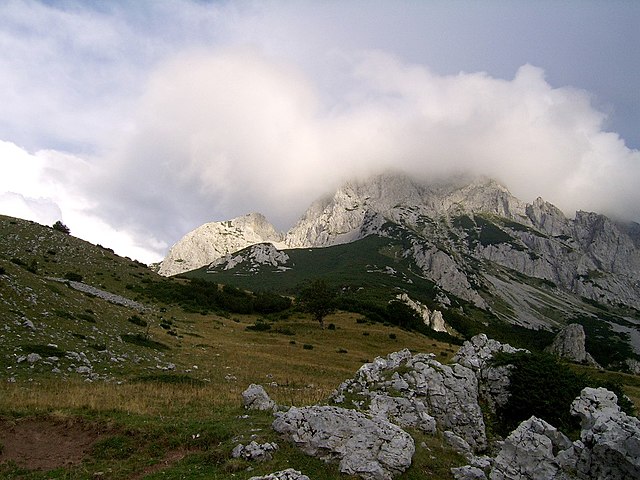
English: Maglić - the highest peak of Bosnia&Herzegovina Polski: Maglić - najwyższy szczyt Bośni i Hercegowiny Bosanski: Maglić - najviši planinski vrh Bosne i Hercegovine Українська: Гора Маґлич, Боснія та Герцеговина |
| Дата | |
| Крыніца | Уласная праца |
| Аўтар | Radosław Botev |
| Дазвол (Паўторнае выкарыстанне гэтага файла) |
This image is copyrighted by Radosław Botev. Permission is granted to use this picture freely for any purpose - whether commercial or not - and to make derivative works provided that the copyright holder's full name is quoted. You are also hereby permitted to redistribute this file and its derivations to a third party under any license of your choice as long as that license requires attribution to the copyright holder of this work and does not allow to ever revoke that requirement (possible examples are Creative Commons Attribution or GFDL). This shall by no means limit the right of the redistributor of this work or the right of the derivative works' creators to impose other restrictions on the use or further redistribution of this work or its derivations. English français polski +/- |
Я, уладальнік аўтарскіх правоў на гэты твор, добраахвотна публікую яго на ўмовах наступнай ліцэнзіі:

|
Уладальнік аўтарскіх правоў на гэты файл дазваляе ўсім выкарыстоўваць яго ў любых мэтах, пры ўмове, што уладальнік правоў пазначаны належным чынам. Распаўсюджанне, стварэнне вытворных твораў, камерцыйнае выкарыстанне і іншыя выкарыстанні дазволеныя. |
|
|
English: This file was originally published under one of the following licenses: Creative Commons Attribution ShareAlike 2.5 Poland or Creative Commons Attribution 2.5 Poland and was later relicensed by its creator Radosław Botev. The current license is less restrictive and still permits the use of this image under the original license. Polski: Ten plik był pierwotnie opublikowany na jednej z następujących licencji: Creative Commons Uznanie Autorstwa - Na tych samych warunkach 2.5 Polska lub Creative Commons Uznanie Autorstwa 2.5 Polska. Twórca tej pracy Radosław Botev zmienił później licencję. Obecna licencja jest mniej restrykcyjna i wciąż zezwala na wykorzystanie tej grafiki na zasadach przewidzianych w pierwotnej licencji.
|
Гісторыя файла
Націснуць на даце з часам, каб паказаць файл, якім ён тады быў.
| Дата і час | Драбніца | Памеры | Удзельнік | Тлумачэнне | |
|---|---|---|---|---|---|
| актуальн. | 12:50, 13 верасня 2006 | | 1 024 × 768 (212 KB) | Botev | {{Information |Description=Sutjeska National Park |Source= |Date=September, 2006 |Author=Botev |Permission=own work |other_versions= }} |
Выкарыстанне файла
Наступная 1 старонка выкарыстоўвае гэты файл:
Глабальнае выкарыстанне файла
Гэты файл выкарыстоўваецца ў наступных вікі:
- Выкарыстанне ў ar.wikipedia.org
- Выкарыстанне ў azb.wikipedia.org
- Выкарыстанне ў bg.wikipedia.org
- Выкарыстанне ў bs.wikipedia.org
- Выкарыстанне ў cs.wikipedia.org
- Выкарыстанне ў de.wikipedia.org
- Выкарыстанне ў eo.wikipedia.org
- Выкарыстанне ў es.wikipedia.org
- Выкарыстанне ў fa.wikipedia.org
- Выкарыстанне ў fr.wikipedia.org
- Выкарыстанне ў gl.wikipedia.org
- Выкарыстанне ў hr.wikipedia.org
- Выкарыстанне ў id.wikipedia.org
- Выкарыстанне ў it.wikipedia.org
- Выкарыстанне ў lmo.wikipedia.org
- Выкарыстанне ў lt.wikipedia.org
- Выкарыстанне ў mk.wikipedia.org
- Выкарыстанне ў mt.wikipedia.org
- Выкарыстанне ў nl.wikipedia.org
- Выкарыстанне ў no.wikipedia.org
- Выкарыстанне ў pl.wikipedia.org
- Выкарыстанне ў pt.wikipedia.org
- Выкарыстанне ў roa-rup.wikipedia.org
- Выкарыстанне ў ro.wikipedia.org
- Выкарыстанне ў ru.wikipedia.org
- Выкарыстанне ў sh.wikipedia.org
- Выкарыстанне ў sq.wikipedia.org
- Выкарыстанне ў sq.wikibooks.org
- Выкарыстанне ў sr.wikipedia.org
- Выкарыстанне ў uk.wikipedia.org
- Выкарыстанне ў vi.wikipedia.org
- Выкарыстанне ў www.wikidata.org