Файл:Map of Bremerhaven 1849.jpg

Арыгінальны файл (1 772 × 1 328 кропак, аб’ём файла: 2,13 MB, тып MIME: image/jpeg)
Тлумачэнне
| Апісанне |
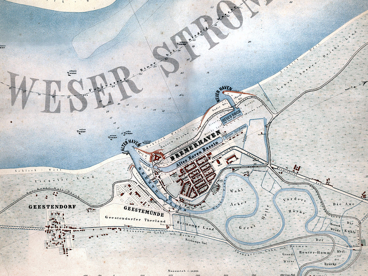
English: Map of the city of Bremerhaven, Germany from the year 1849.
Deutsch: „Bremerhaven mit den in Ausführung begriffenen neuen Havenanlagen“. Karte der Stadt Bremerhaven aus dem Jahr 1849.
Español: Mapa de la ciudad de Bremerhaven del año 1849.
Català: Mapa de la ciutat de Bremerhaven de l’any 1849. |
| Дата | |
| Крыніца | Hochschule Bremerhaven: Die Gebäude der Hochschule Bremerhaven. Wirtschaftsverlag NW, Bremerhaven 2005, ISBN 3-86509-250-0 |
| Аўтар | Georg Hunckel |
| Дазвол (Паўторнае выкарыстанне гэтага файла) |
Public domain because of age. |
| Іншыя версіі | Derivative works of this file: Map of Bremerhaven 1849 2011 11 27 Hochhaus.jpg |
Ліцэнзіяванне
|
This work is in the public domain in its country of origin and other countries and areas where the copyright term is the author's life plus 70 years or fewer.
| |
| Гэты файл быў ідэнтыфікаваны як вольны ад вядомых абмежаванняў, згодна з законам аб аўтарскім праве, а таксама ад усіх сумежных правоў. | |
Гісторыя файла
Націснуць на даце з часам, каб паказаць файл, якім ён тады быў.
| Дата і час | Драбніца | Памеры | Удзельнік | Тлумачэнне | |
|---|---|---|---|---|---|
| актуальн. | 20:03, 29 студзеня 2008 | | 1 772 × 1 328 (2,13 MB) | Gepardenforellenfischer | {{Information |Description= {{en|Map of the city of Bremerhaven from the year 1849.}} {{de|Karte der Stadt Bremerhaven aus dem Jahr 1849.}} {{es|Mapa de la ciudad de Bremerhaven del año 1849.}} {{ca|Mapa de la ciutat de Bremerhaven de l’any 1849.}} |So |
Выкарыстанне файла
Наступная 1 старонка выкарыстоўвае гэты файл:
Глабальнае выкарыстанне файла
Гэты файл выкарыстоўваецца ў наступных вікі:
- Выкарыстанне ў cs.wikipedia.org
- Выкарыстанне ў de.wikipedia.org
- Выкарыстанне ў hu.wikipedia.org
- Выкарыстанне ў hy.wikipedia.org
- Выкарыстанне ў la.wikipedia.org
- Выкарыстанне ў nl.wikipedia.org
- Выкарыстанне ў ru.wikipedia.org
- Выкарыстанне ў zh.wikipedia.org