Файл:Map of Greece 1903.png
Памер папярэдняга прагляду: 752 × 600 пікселяў. Іншыя разрозненні: 301 × 240 пікселяў | 602 × 480 пікселяў | 963 × 768 пікселяў | 1 280 × 1 020 пікселяў | 2 560 × 2 041 пікселяў | 3 472 × 2 768 пікселяў.
Арыгінальны файл (3 472 × 2 768 кропак, аб’ём файла: 15,57 MB, тып MIME: image/png)
Тлумачэнне
| Апісанне |
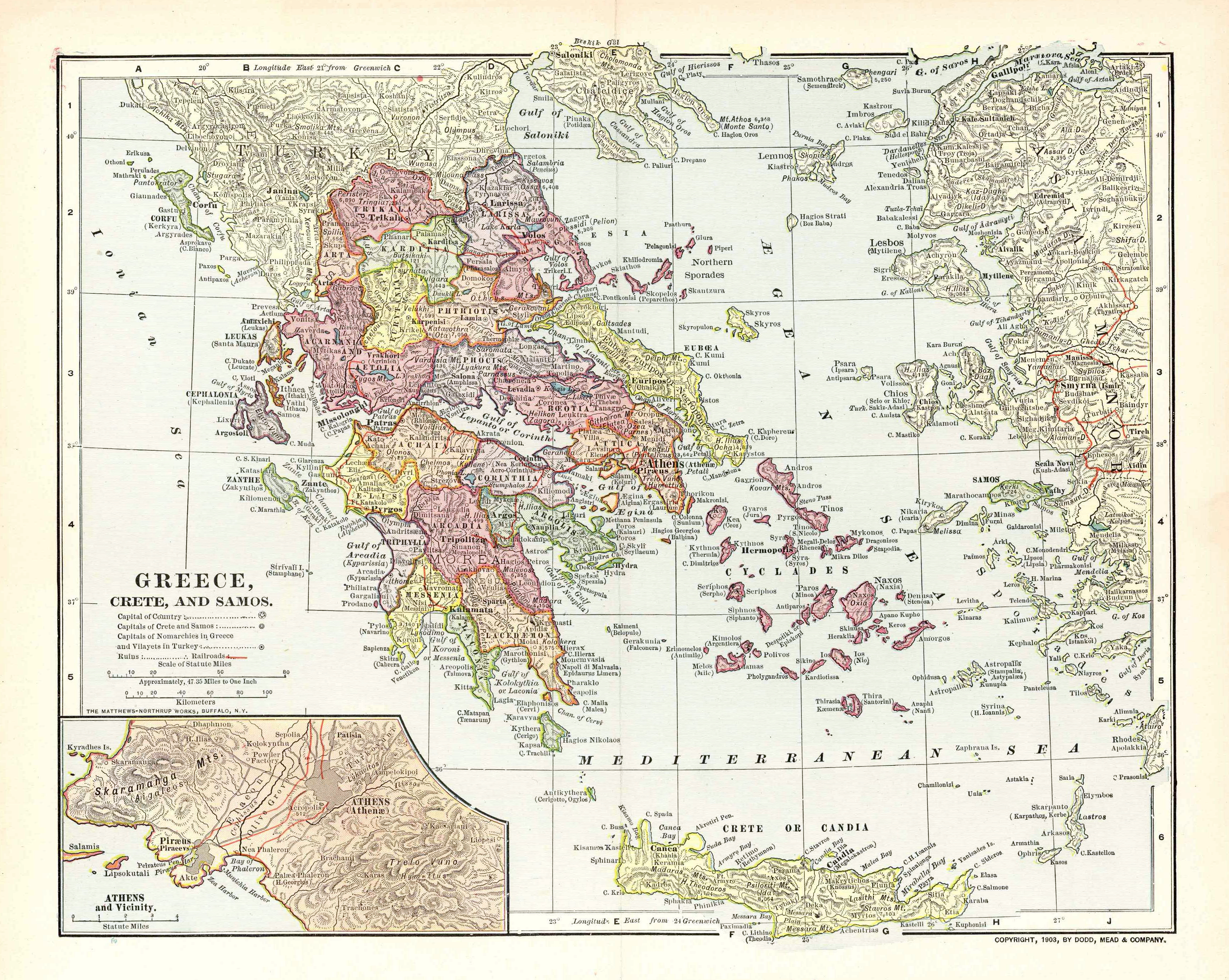
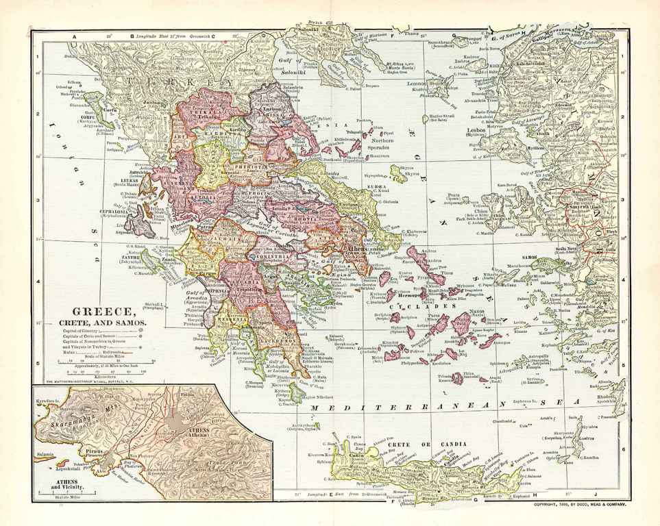
English: Map of the Kingdom of Greece, the Cretan State and the Principality of Samos in 1903. It displays the greek railway network as it was in 1900-1901. |
| Дата | |
| Крыніца | Old map, own collection. Transferred from en.wikipedia to Commons by Sfan00_IMG using CommonsHelper. Original uploader was Sv1xv at en.wikipedia. |
| Аўтар | Unknown. Published by Dodd, Mead & Co. Printed by Mattheus-Northup Works, Buffalo, NY. |
| Дазвол (Паўторнае выкарыстанне гэтага файла) |
PD-US |
| Іншыя версіі |


Ліцэнзіяванне
This media file is in the public domain in the United States. This applies to U.S. works where the copyright has expired, often because its first publication occurred prior to January 1, 1929, and if not then due to lack of notice or renewal. See this page for further explanation.
|
 | |
 |
This image might not be in the public domain outside of the United States; this especially applies in the countries and areas that do not apply the rule of the shorter term for US works, such as Canada, Mainland China (not Hong Kong or Macao), Germany, Mexico, and Switzerland. The creator and year of publication are essential information and must be provided. See Wikipedia:Public domain and Wikipedia:Copyrights for more details.
|
Журнал арыгінальнай загрузкі
The original description page was here. All following user names refer to en.wikipedia.
- 2009-02-10 09:25 Sv1xv 3472×2768× (18736454 bytes) Improved image processing.
- 2009-02-04 13:47 Sv1xv 2048×1648× (6459711 bytes) {{Information |Description=Map of Greece and surrounding area in 1903 |Source=Old map |Date=1903 |Author=Dodd, Mead & Co |Permission={{Stamp-PD-US-1923-abroad}} |other_versions= }}
The original description page was here. All following user names refer to en.wikipedia.
- 2009-12-30 23:31 Little Professor 3472×2768× (16329431 bytes) losslessly optimized with [[PNGOut]]
- 2009-02-10 09:25 Sv1xv 3472×2768× (18736454 bytes) Improved image processing.
- 2009-02-04 13:47 Sv1xv 2048×1648× (6459711 bytes) {{Information |Description=Map of Greece and surrounding area in 1903 |Source=Old map |Date=1903 |Author=Dodd, Mead & Co |Permission={{Stamp-PD-US-1923-abroad}} |other_versions= }}
Гісторыя файла
Націснуць на даце з часам, каб паказаць файл, якім ён тады быў.
| Дата і час | Драбніца | Памеры | Удзельнік | Тлумачэнне | |
|---|---|---|---|---|---|
| актуальн. | 20:26, 4 кастрычніка 2015 | | 3 472 × 2 768 (15,57 MB) | OgreBot | (BOT): Uploading old version of file from en.wikipedia; originally uploaded on 2009-12-30 23:31:35 by Little Professor |
| 20:26, 4 кастрычніка 2015 |  | 2 048 × 1 648 (6,16 MB) | OgreBot | (BOT): Uploading old version of file from en.wikipedia; originally uploaded on 2009-02-04 13:47:18 by Sv1xv | |
| 13:26, 21 красавіка 2009 |  | 3 472 × 2 768 (17,97 MB) | Sv1xv | Improved contrast. | |
| 12:07, 21 красавіка 2009 |  | 3 472 × 2 768 (17,87 MB) | File Upload Bot (Magnus Manske) | {{BotMoveToCommons|en.wikipedia|year={{subst:CURRENTYEAR}}|month={{subst:CURRENTMONTHNAME}}|day={{subst:CURRENTDAY}}}} {{Information |Description={{en|Map of the Kingdom of Greece, the en:Cretan State and the Principality of [[:en:Samos Island|Samo |
Выкарыстанне файла
Наступныя 2 старонкі выкарыстоўваюць гэты файл:
Глабальнае выкарыстанне файла
Гэты файл выкарыстоўваецца ў наступных вікі:
- Выкарыстанне ў ar.wikipedia.org
- Выкарыстанне ў azb.wikipedia.org
- Выкарыстанне ў de.wikipedia.org
- Выкарыстанне ў el.wikipedia.org
- Выкарыстанне ў es.wikipedia.org
- Выкарыстанне ў fr.wikipedia.org
- Выкарыстанне ў hy.wikipedia.org
- Выкарыстанне ў ko.wikipedia.org
- Выкарыстанне ў mk.wikipedia.org
- Выкарыстанне ў ru.wikipedia.org