Файл:Heiliges Römisches Reich 1400.png
Памер папярэдняга прагляду: 727 × 599 пікселяў. Іншыя разрозненні: 291 × 240 пікселяў | 582 × 480 пікселяў | 931 × 768 пікселяў | 1 242 × 1 024 пікселяў | 2 484 × 2 048 пікселяў | 2 788 × 2 299 пікселяў.
Арыгінальны файл (2 788 × 2 299 кропак, аб’ём файла: 2,47 MB, тып MIME: image/png)
Тлумачэнне
| Апісанне |
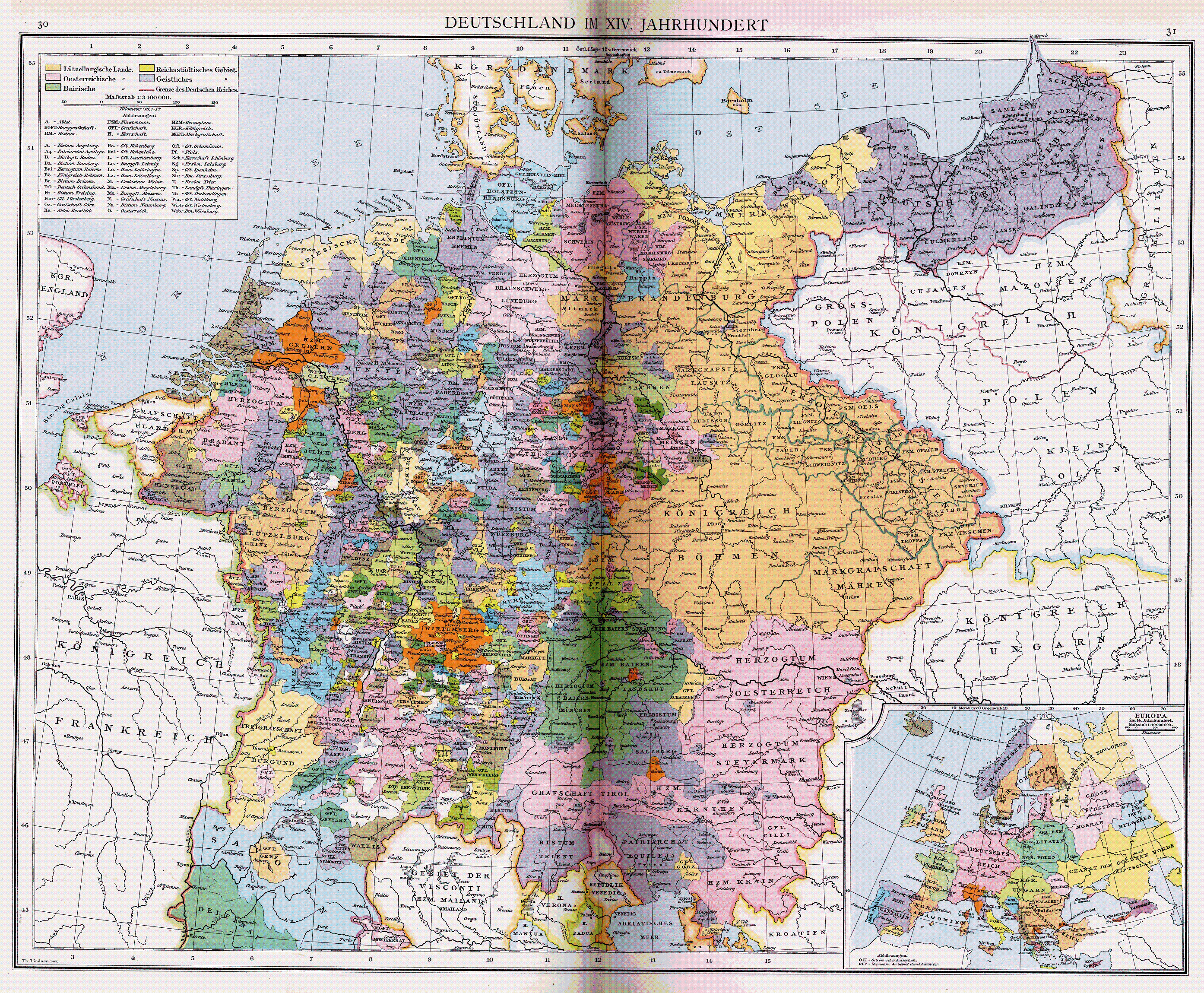
Deutsch: Heiliges Römisches Reich um 1400 |
| Дата | |
| Крыніца |
Deutsch: Allgemeiner historischer Handatlas |
| Стваральнік твора |
Deutsch: Gustav Droysen (1838–1908) |
| Georeferencing | If inappropriate please set warp_status = skip to hide. |
| Іншыя версіі |
Derivative works of this file: |
Ліцэнзіяванне
|
This work is in the public domain in its country of origin and other countries and areas where the copyright term is the author's life plus 100 years or fewer. | |
| Гэты файл быў ідэнтыфікаваны як вольны ад вядомых абмежаванняў, згодна з законам аб аўтарскім праве, а таксама ад усіх сумежных правоў. | |
Гісторыя файла
Націснуць на даце з часам, каб паказаць файл, якім ён тады быў.
| Дата і час | Драбніца | Памеры | Удзельнік | Тлумачэнне | |
|---|---|---|---|---|---|
| актуальн. | 21:22, 26 ліпеня 2007 | | 2 788 × 2 299 (2,47 MB) | Alma | {{Information |Description=Heiliges Römisches Reich um 1400 |Source=Allgemeiner historischer Handatlas |Date=1886 |Author=Gustav Droysen |Permission= |other_versions= }} {{pd-old}} |
Выкарыстанне файла
Няма старонак, якія выкарыстоўваюць гэты файл.
Глабальнае выкарыстанне файла
Гэты файл выкарыстоўваецца ў наступных вікі:
- Выкарыстанне ў de.wikipedia.org
- Выкарыстанне ў hu.wikipedia.org
- Выкарыстанне ў ja.wikipedia.org
- Выкарыстанне ў stq.wikipedia.org