Файл:Map indicating McClure Strait, Northwest Territories, Canada.png
Map_indicating_McClure_Strait,_Northwest_Territories,_Canada.png (420 × 380 кропак, аб’ём файла: 59 KB, тып MIME: image/png)
Тлумачэнне
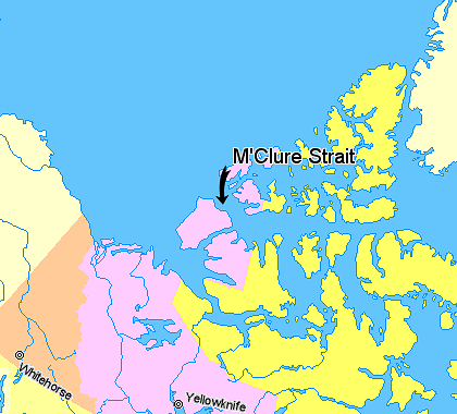
Map indicating McClure Strait (M'Clure Strait), Northwest Territories, Canada.
© Her Majesty the Queen in Right of Canada, Department of Natural Resources. All rights reserved.
Licence Agreement
Ліцэнзіяванне

|
The copyright holder of this work allows anyone to use it for any purpose including unrestricted redistribution, commercial use, and modification.
Usage notes:
|
Гісторыя файла
Націснуць на даце з часам, каб паказаць файл, якім ён тады быў.
| Дата і час | Драбніца | Памеры | Удзельнік | Тлумачэнне | |
|---|---|---|---|---|---|
| актуальн. | 02:16, 21 сакавіка 2006 | | 420 × 380 (59 KB) | David Kernow~commonswiki | Map indicating Banks Island, Northwest Territories, Canada. {{legend|#ffff66|Nunavut}} {{legend|#ffccff|Northwest Territories}} {{legend|#ffcc99|Yukon Territory}} {{legend|#ffffcc|Regions outside Canada (Alaska, Greenland)}} <br> © He |
Выкарыстанне файла
Наступная 1 старонка выкарыстоўвае гэты файл:
Глабальнае выкарыстанне файла
Гэты файл выкарыстоўваецца ў наступных вікі:
- Выкарыстанне ў az.wikipedia.org
- Выкарыстанне ў bn.wikipedia.org
- Выкарыстанне ў ca.wikipedia.org
- Выкарыстанне ў da.wikipedia.org
- Выкарыстанне ў de.wikipedia.org
- Выкарыстанне ў en.wikipedia.org
- Выкарыстанне ў es.wikipedia.org
- Выкарыстанне ў fi.wikipedia.org
- Выкарыстанне ў fr.wikipedia.org
- Выкарыстанне ў he.wikipedia.org
- Выкарыстанне ў ja.wikipedia.org
- Выкарыстанне ў ka.wikipedia.org
- Выкарыстанне ў lt.wikipedia.org
- Выкарыстанне ў ml.wikipedia.org
- Выкарыстанне ў new.wikipedia.org
- Выкарыстанне ў nl.wikipedia.org
- Выкарыстанне ў nn.wikipedia.org
- Выкарыстанне ў pl.wikipedia.org
- Выкарыстанне ў pt.wikipedia.org
- Выкарыстанне ў sv.wikipedia.org
- Выкарыстанне ў tr.wikipedia.org
- Выкарыстанне ў zh.wikipedia.org