Файл:Map of the historical region of (Iranian) Azerbaijan.png
Памер папярэдняга прагляду: 652 × 600 пікселяў. Іншыя разрозненні: 261 × 240 пікселяў | 522 × 480 пікселяў | 895 × 823 пікселяў.
Арыгінальны файл (895 × 823 кропак, аб’ём файла: 22 KB, тып MIME: image/png)
_Azerbaijan.png)
Тлумачэнне
| Апісанне |
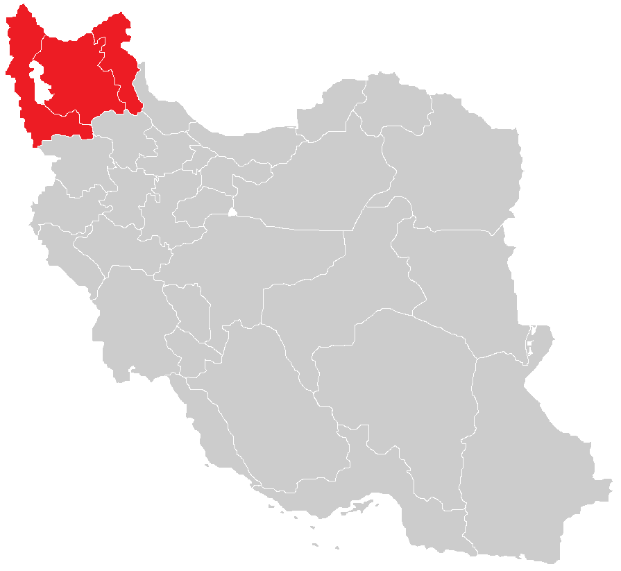
English: Map of the historical region of (Iranian) Azerbaijan |
| Дата | |
| Крыніца |
https://commons.wikimedia.org/w/index.php?title=File:Iranian-Azerbaijan.png&dir=prev#filehistory Based on the sources;
|
| Аўтар | HistoryofIran |
Ліцэнзіяванне
Гэты файл даступны па ліцэнзіі Creative Commons Пазначэнне аўтарства - На тых самых умовах 3.0 Міжнародны
- Вы можаце свабодна:
- дзяліцца творам – капіраваць, распаўсюджваць і перадаваць гэты твор.
- ствараць вытворныя творы – адаптаваць гэты твор
- Пры выкананні наступных умоў:
- атрыбуцыя – вы павінны пазначыць аўтарства гэтага твора, даць спасылку на ліцэнзію і пазначыць ці рабіў аўтар якія-небудзь змены. Гэта можна рабіць кожным зразумелым чынам, але не так, каб наводзіць па думку, што ліцэнзіят падтрымлівае вас або выкарыстанне вамі гэтага твора.
- распаўсюджванне на тых жа ўмовах – Калі вы змяняеце, адаптуеце ці ствараеце вытворны твор на аснове гэтага, то павінны распаўсюджваць атрыманы ў выніку твор на ўмовах такой самай ці сумяшчальнай ліцэнзіі, што і арыгінал.

|
This map image could be re-created using vector graphics as an SVG file. This has several advantages; see Commons:Media for cleanup for more information. If an SVG form of this image is available, please upload it and afterwards replace this template with
{{vector version available|new image name}}.
It is recommended to name the SVG file “Map of the historical region of (Iranian) Azerbaijan.svg”—then the template Vector version available (or Vva) does not need the new image name parameter. |
Гісторыя файла
Націснуць на даце з часам, каб паказаць файл, якім ён тады быў.
| Дата і час | Драбніца | Памеры | Удзельнік | Тлумачэнне | |
|---|---|---|---|---|---|
| актуальн. | 16:28, 29 верасня 2023 | | 895 × 823 (22 KB) | HistoryofIran | rv, WP:RS contradicts this. |
| 12:24, 27 верасня 2023 |  | 895 × 823 (15 KB) | AkaneoMT | Added Zanjan province as a contested part of historical Azerbaijan | |
| 14:59, 19 студзеня 2022 |  | 895 × 823 (22 KB) | HistoryofIran | Uploaded a work by HistoryofIran from https://commons.wikimedia.org/w/index.php?title=File:Iranian-Azerbaijan.png&dir=prev#filehistory with UploadWizard |
Выкарыстанне файла
Наступная 1 старонка выкарыстоўвае гэты файл:
Глабальнае выкарыстанне файла
Гэты файл выкарыстоўваецца ў наступных вікі:
- Выкарыстанне ў azb.wikipedia.org
- Выкарыстанне ў az.wikipedia.org
- Выкарыстанне ў bn.wikipedia.org
- Выкарыстанне ў ca.wikipedia.org
- Выкарыстанне ў diq.wikipedia.org
- Выкарыстанне ў en.wikipedia.org
- Выкарыстанне ў eo.wikipedia.org
- Выкарыстанне ў eu.wikipedia.org
- Выкарыстанне ў fr.wikipedia.org
- Выкарыстанне ў ga.wikipedia.org
- Выкарыстанне ў id.wikipedia.org
- Выкарыстанне ў ku.wikipedia.org
- Выкарыстанне ў lv.wikipedia.org
- Выкарыстанне ў mg.wikipedia.org
- Выкарыстанне ў ms.wikipedia.org
- Выкарыстанне ў nl.wikipedia.org
- Выкарыстанне ў pt.wikipedia.org
- Выкарыстанне ў ru.wikipedia.org
- Выкарыстанне ў sh.wikipedia.org
- Выкарыстанне ў simple.wikipedia.org
- Выкарыстанне ў sr.wikipedia.org
- Выкарыстанне ў uk.wikipedia.org
- Выкарыстанне ў www.wikidata.org
_Azerbaijan.png)